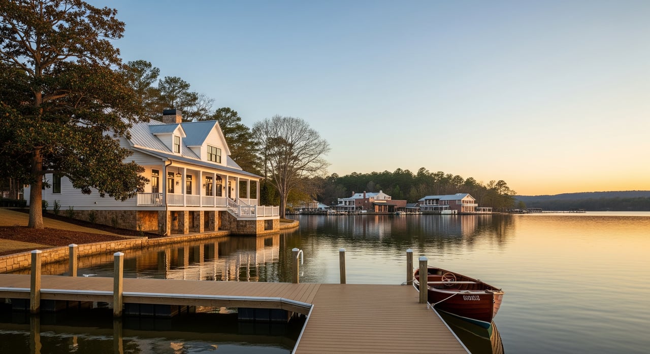
Ever stared at a Smith Lake plat map and felt like you were decoding a puzzle? You are not alone. If you are eyeing a waterfront lot near Houston in Winston County, the lines, curves, and notes on a recorded plat map can make or break your plans for a home site or dock. In this guide, you will learn exactly how to read a plat map, what to verify for shoreline use, and when to bring in a licensed surveyor so you can buy with confidence. Let’s dive in.
Start with the basics
A plat map is a recorded drawing that lays out lots, streets, easements, and sometimes building restriction lines for a subdivision. It is filed with the county and used in deed descriptions. It is not the same as a boundary survey, but it shows the legal layout as recorded.
Begin by finding the legend, north arrow, and scale. The scale tells you how to convert map inches to feet on the ground. Use the north arrow to orient the lot to the lake and nearby roads so you can picture access and views.
Check the title block for the subdivision name, recording date, and book and page or instrument number. Note the county office where it was filed. The recording date helps you know if there could be amendments or replats to look up before you close.
Find and read lot details
Each lot should have a clear number or label. Your deed will reference that lot number, sometimes with a block label.
Look for the linear dimensions and bearings along each boundary. Straight lines will show a length in feet and a bearing in degrees, minutes, and seconds. Curved lakefront lines may be tied to a curve table listing radius, arc length, chord length, and chord bearing.
Some plats list total area in square feet or acres. Treat this as helpful but confirm critical area questions with a survey if you need precise sizing for setbacks or septic planning.
Spot easements and ROW
Easements and rights‑of‑way are critical. Common ones include utility easements, drainage easements, access or ingress/egress easements, and road rights‑of‑way. They are often labeled with width, such as 20' U.E. for a utility easement.
Identify any easements crossing the lot or running along the shoreline and roads. Easements can limit where you place permanent structures. If access is via a private drive, confirm the recorded ingress/egress easement provides legal access to a public road.
If the plat mentions shoreline or TVA easements, note the exact location and width. These can affect docks, vegetation removal, and shoreline work.
Check setbacks and BRLs
Some plats show building restriction lines or setback lines that keep structures a certain distance from roads, property lines, or the shoreline. If you see them, they are binding for building placement.
If a plat does not show setbacks, do not assume there are none. County rules, health department septic setbacks, subdivision covenants, and TVA shoreline rules can all apply. Ask for the local rules and any recorded restrictions that govern the lot.
Understand shoreline lines
On Smith Lake, plats may label the shoreline in different ways, such as shoreline, high water line, meander line, full pool, or reservoir line. These labels tell you which water boundary was used when the lot was created.
Because Smith Lake is a TVA reservoir, plats may reference a full pool elevation or a TVA meander line. Land and rights below certain elevations can fall under TVA jurisdiction. Read the notes to see which line controls the boundary.
Pay close attention to any callouts along the water’s edge. Where your private ownership ends, and what restrictions apply, can depend on the exact shoreline reference used on the plat and in the deed.
Watch TVA rules and docks
TVA manages Smith Lake’s shoreline under its Shoreline Management Program. This program assigns classifications and can limit structures, docks, and vegetation removal along the shore. Owning waterfront access does not guarantee the right to build a dock.
Before you assume dock rights, confirm the shoreline classification, the presence of any TVA shoreline easements, and permit steps for docks or shoreline stabilization. Some subdivisions use shared docks or common dock areas; check the plat and the covenants for those details.
If a plat note references a TVA instrument or easement, request the full recorded document to understand all terms and restrictions.
Confirm flood and elevation
FEMA flood maps show areas subject to flooding. If your lot lies in a Special Flood Hazard Area, it can affect foundation decisions and insurance costs. Ask for the current flood zone and any Base Flood Elevation that applies.
If the property is close to the water, a licensed surveyor can prepare an elevation certificate to document finished floor and other elevations. This supports insurance and design decisions and helps you meet any local or lender requirements.
Plan for septic and wells
Many rural Smith Lake lots rely on on‑site septic and wells. The local health or environmental health department sets minimum setbacks from property lines, waterbodies, and neighboring systems.
These rules directly influence where you can place a house, driveway, and outdoor features. Confirm the septic feasibility early, because slopes and soil conditions on lakefront lots can tighten your building envelope.
When to order a survey
Order a new survey when boundaries or encroachments matter to your purchase. If the plat is old or monuments are missing, a survey helps re‑establish corners and confirm what exists on the ground.
Get a survey before construction so you can stake the house, septic, and driveway within setbacks, easements, and building restriction lines. Lenders and title companies may also require a recent survey to clear closing conditions.
If you see any inconsistencies between the plat and visible features, or if a neighbor’s fence or driveway appears near your line, bring in a surveyor before you proceed.
Types of surveys to consider
- Boundary survey: Confirms lot corners and dimensions. This is the most common for residential lots.
- ALTA/NSPS survey: A more comprehensive map that includes recorded easements and visible improvements. Often used for complex or higher‑value transactions.
- Topographic survey: Adds contours and elevations. Helpful for sloped lakefront sites and grading plans.
- FEMA Elevation Certificate: Prepared by a licensed surveyor when required for flood insurance or compliance.
Who to hire locally
Hire an Alabama‑licensed land surveyor with experience on TVA reservoirs and Smith Lake. Ask for recent lakefront references and example maps. Confirm their scope will include finding or setting monuments and mapping recorded easements that affect your lot.
Survey timelines can range from days to weeks based on terrain, lot size, and research needs. Costs vary by complexity, number of corners, shoreline conditions, and title research. Request detailed estimates from multiple surveyors so you can compare scope and schedule.
Your on‑the‑ground checklist
Use this checklist as you evaluate a Smith Lake lot near Houston in Winston County.
Documents to request
- Recorded plat and any replat or amendments
- Current deed and legal description
- Subdivision covenants, conditions, and restrictions
- All recorded easements referenced on the plat, including any TVA shoreline easements
- Any recent surveys or boundary maps
- Title commitment or preliminary title report
Questions to ask while reviewing the plat
- Are there shoreline or TVA easements on the lot? What are the exact dimensions and restrictions?
- Where are the utility and drainage easements relative to my proposed build site?
- Is legal access provided through a recorded ingress/egress easement if there is no public road frontage?
- Are building restriction lines shown? If not, which county, health, or HOA rules set setbacks?
- Which shoreline line controls the boundary: high water line, meander line, or full pool reference?
- Are there shared dock or common area docking agreements?
Field checks you can do
- Walk the lot with the plat in hand. Look for visible monuments, stakes, or pins at corners.
- Note utilities, meters, drainage features, and any visible easement corridors.
- Watch for encroachments like fences or driveways that appear to cross lines shown on the plat.
Local contacts to confirm details
- Winston County probate or recorder for official plats, deeds, and instrument lookups
- TVA Shoreline Management Program for shoreline classification and dock permitting
- FEMA Flood Map Service Center or the local floodplain administrator for flood zones and BFE
- Local environmental health department for septic permitting and setbacks
- An Alabama‑licensed land surveyor with Smith Lake experience
- A title company or attorney for title commitments and recorded encumbrances
- U.S. Army Corps of Engineers if shoreline or wetland work could require permits
Common pitfalls
Avoid these issues that often surprise lake buyers.
- Assuming your ownership extends to the water’s edge without checking TVA references on the plat or in the deed
- Skipping separate recorded easements that the plat references by instrument number
- Relying on an old plat without a current survey when monuments are unclear
- Ignoring flood zone and elevation impacts on foundation design and insurance
- Assuming a private dock is allowed without confirming TVA SMP rules and permits
Next steps
Reading the plat map is your starting point, not the finish line. Confirm shoreline classifications with TVA, verify flood zones, and understand all easements that affect building and dock plans. When boundaries or build placement matter, order a recent survey from an Alabama‑licensed professional.
If you want a local guide who lives and breathes Smith Lake, reach out to Macy Hinds Teer for a concierge review of your short list. You will get clear next steps, vetted local contacts, and expert representation from offer to closing.
FAQs
What is a plat map vs. a survey on Smith Lake?
- A plat is the recorded layout of lots, easements, and streets, while a survey confirms current on‑the‑ground boundaries, monuments, and encroachments for your specific parcel.
How do TVA rules affect dock plans near Houston, AL?
- TVA’s Shoreline Management Program sets classifications and permit requirements that can limit docks, shoreline work, and vegetation removal along Smith Lake.
What do curved shoreline numbers mean on my plat?
- Curves list arc length, radius, and chord data, often summarized in a curve table, to precisely define a curved boundary along the water.
When should I order a new survey for a lot purchase?
- Order before closing if lines are unclear, when the plat is old, before construction, if a lender requires it, or if you see potential encroachments or inconsistencies.
How do flood zones impact a lakefront build?
- Flood zones can affect foundation design, finished floor elevations, and insurance needs; a surveyor can provide an elevation certificate if required.
Who keeps official plat records for Winston County?
- The Winston County probate or recorder’s office maintains recorded plats, deeds, and instrument numbers for subdivision filings and parcel records.
What should I ask the seller before making an offer?
- Ask for the recorded plat and amendments, deed, covenants, referenced easements, any recent surveys, and a preliminary title commitment for a full view of encumbrances.